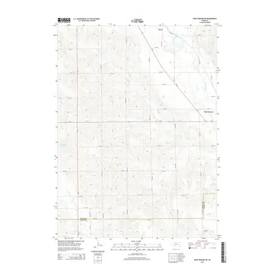
2014 Map of Saint Edward SW
USGS Topo · Published 2014About this map
Saint Edward and the small community of Boone anchor this agricultural landscape in eastern Nebraska. The map illustrates a highly organized section-line road network typical of the Great Plains, where routes like Valley Rd and Road 137 intersect a terrain defined by subtle drainage patterns. Water management is a primary feature of the region, evident in the numerous named catchments such as Jasa Reservoir, Goodwater Reservoir, and Roberts Reservoir. These artificial water bodies supplement a network of natural streams including Beaver Creek, Bogus Cr, and Plum Cr. Along the southern boundary, the transition between Boone Co and Nance Co is clearly marked, providing a precise reference for those researching land ownership or local history near the Skeedee Cem. This 2014 survey documents the enduring rural character and hydrologic infrastructure of the area just southwest of the primary Saint Edward settlement.
Find a feature on this map
25 named features on this map. Tap any name to fly to it.
Don’t see what you’re looking for? This feature index may not catch every label — zoom into the map to look around manually.
Map Details
Editions of this 2014 Saint Edward SW Map
This is the sole edition of this map. No revisions or reprints were ever made.
Other maps of this area

1896 · Stromsburg
USGS Topo · 1:125,000

1899 · St. Paul
USGS Topo · 1:125,000

1954 · Albion West
USGS Topo · 1:24,000

1954 · Belgrade
USGS Topo · 1:24,000

1954 · Cedar Rapids SE
USGS Topo · 1:24,000

1955 · Broken Bow
USGS Topo · 1:250,000

1955 · Fremont
USGS Topo · 1:250,000

1956 · Broken Bow
USGS Topo · 1:250,000

1957 · Fremont
USGS Topo · 1:250,000

1958 · Fremont
USGS Topo · 1:250,000