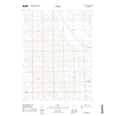
2017 Map of Saint Edward SW
USGS Topo · Published 2017About this map
Beaver Creek and its many tributaries carve a network of drainages across this section of the Nebraska plains, defining a landscape of agriculture and water management. Near the edge of Saint Edward, the topography reveals a reliance on local water storage with several named impoundments, including Goodwater Reservoir, Jasa Reservoir, and Roberts Reservoir. The rural infrastructure is organized by a strict section-line road grid, including 290th Ave and 330th St, which connects isolated farmsteads and rural landmarks.
Find a feature on this map
34 named features on this map. Tap any name to fly to it.
Don’t see what you’re looking for? This feature index may not catch every label — zoom into the map to look around manually.
Map Details
Editions of this 2017 Saint Edward SW Map
This is the sole edition of this map. No revisions or reprints were ever made.
Other maps of this area

1896 · Stromsburg
USGS Topo · 1:125,000

1899 · St. Paul
USGS Topo · 1:125,000

1954 · Albion West
USGS Topo · 1:24,000

1954 · Belgrade
USGS Topo · 1:24,000

1954 · Cedar Rapids SE
USGS Topo · 1:24,000

1955 · Broken Bow
USGS Topo · 1:250,000

1955 · Fremont
USGS Topo · 1:250,000

1956 · Broken Bow
USGS Topo · 1:250,000

1957 · Fremont
USGS Topo · 1:250,000

1958 · Fremont
USGS Topo · 1:250,000