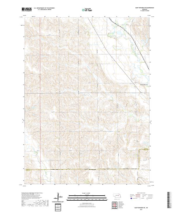
2021 Map of Saint Edward SW
USGS Topo · Published 2021About this map
Beaver Creek and its various tributaries, including Bogus Cr and Verheecs Cr, carve a complex drainage pattern across this section of the Nebraska plains. The landscape is defined by the high concentration of managed water resources, notably Jasa Reservoir in the northeast and Goodwater Reservoir to the west. While much of the terrain is dedicated to agricultural use, the presence of Saint Edward on the eastern margin and the Skeedee Cem near the southern border provides focal points for local history and genealogy. The county line between Boone Co and Nance Co runs horizontally across the southern portion of the sheet, dividing the townships of t18n r5w and t19n r5w. This network of rural roads, such as N 440th ST, follows the established section lines of the Public Land Survey System, illustrating the orderly settlement pattern typical of the region.
Find a feature on this map
39 named features on this map. Tap any name to fly to it.
Don’t see what you’re looking for? This feature index may not catch every label — zoom into the map to look around manually.
Map Details
Editions of this 2021 Saint Edward SW Map
This is the sole edition of this map. No revisions or reprints were ever made.
Other maps of this area

1896 · Stromsburg
USGS Topo · 1:125,000

1899 · St. Paul
USGS Topo · 1:125,000

1954 · Albion West
USGS Topo · 1:24,000

1954 · Belgrade
USGS Topo · 1:24,000

1954 · Cedar Rapids SE
USGS Topo · 1:24,000

1955 · Broken Bow
USGS Topo · 1:250,000

1955 · Fremont
USGS Topo · 1:250,000

1956 · Broken Bow
USGS Topo · 1:250,000

1957 · Fremont
USGS Topo · 1:250,000

1958 · Fremont
USGS Topo · 1:250,000