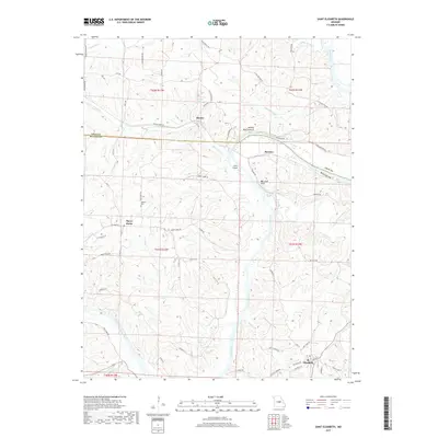
2017 Map of Saint Elizabeth
USGS Topo · Published 2017About this map
The Osage River winds through the border of Miller and Cole counties, defining a landscape of deep creek valleys and distinctive geological formations. Near the settlement of Hoecker, the river passes Jones Island and the notable Bat Cave Arch, while further north, the Henley Natural Arch stands near Henley and Henley Lake. These natural landmarks sit amidst a network of rural communities, including Marys Home and St. Elizabeth in the southern portion of the survey. The transport and social fabric of the era is evidenced by local landmarks such as Jenkins Cem and the complex drainage of Tavern Creek and Little Tavern Cr. This topography reflects the early 21st-century rural character of the Missouri Ozark foothills, where small settlements remain centered around key watercourses and regional routes like Rte H and Rte BB.
Find a feature on this map
67 named features on this map. Tap any name to fly to it.
Don’t see what you’re looking for? This feature index may not catch every label — zoom into the map to look around manually.
Map Details
Editions of this 2017 Saint Elizabeth Map
This is the sole edition of this map. No revisions or reprints were ever made.
Other maps of this area

1888 · Tuscumbia
USGS Topo · 1:125,000

1894 · Tuscumbia
USGS Topo · 1:125,000

1933 · Iberia
USGS Topo · 1:62,500

1937 · Iberia
USGS Topo · 1:62,500

1947 · Jefferson City
USGS Topo · 1:250,000

1948 · Meta
USGS Topo · 1:62,500
1948 · Eugene
USGS Topo · 1:62,500

1948 · Tavern
USGS Topo · 1:62,500
1950 · Meta
USGS Topo · 1:62,500
1950 · Tavern
USGS Topo · 1:62,500