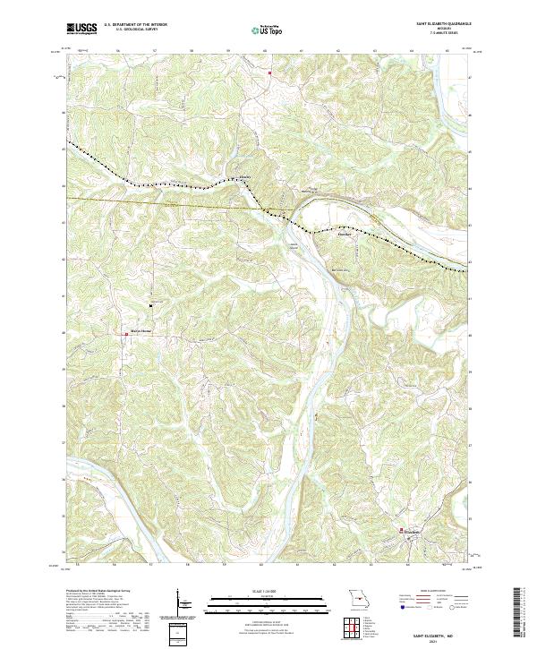
2021 Map of Saint Elizabeth
USGS Topo · Published 2021About this map
The Osage River carves a deep, winding path through the borderlands of Cole and Miller counties, anchoring a landscape defined by sharp ridges and narrow creek bottoms. Small rural communities like St. Elizabeth and Marys Home serve as the primary nodes of settlement, connected by a network of winding county roads such as Marys Home Rd and Koetting Rd. The rugged topography is punctuated by distinct geological landmarks, most notably the Henley Natural Arch and Bat Cave Arch, which highlight the region's karst characteristics near the river bluffs.
Find a feature on this map
63 named features on this map. Tap any name to fly to it.
Don’t see what you’re looking for? This feature index may not catch every label — zoom into the map to look around manually.
Map Details
Editions of this 2021 Saint Elizabeth Map
This is the sole edition of this map. No revisions or reprints were ever made.
Other maps of this area

1888 · Tuscumbia
USGS Topo · 1:125,000

1894 · Tuscumbia
USGS Topo · 1:125,000

1933 · Iberia
USGS Topo · 1:62,500

1937 · Iberia
USGS Topo · 1:62,500

1947 · Jefferson City
USGS Topo · 1:250,000

1948 · Meta
USGS Topo · 1:62,500
1948 · Eugene
USGS Topo · 1:62,500

1948 · Tavern
USGS Topo · 1:62,500
1950 · Meta
USGS Topo · 1:62,500
1950 · Tavern
USGS Topo · 1:62,500