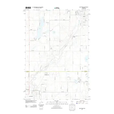
2013 Map of Saint Francis
USGS Topo · Published 2013About this map
The Rum River winds diagonally across the landscape, connecting the small northern settlements of Isanti and Bethel with Saint Francis to the southwest. This 2013 survey reveals a transitional area on the border of Isanti and Anoka counties, where agricultural grids meet growing residential pockets like Woodlyn Court. The terrain is defined by a dense cluster of glacial water bodies, including Long Lake, Lake Francis, and Marget Lake, which have shaped local recreation and settlement patterns.
Find a feature on this map
48 named features on this map. Tap any name to fly to it.
Don’t see what you’re looking for? This feature index may not catch every label — zoom into the map to look around manually.
Map Details
Editions of this 2013 Saint Francis Map
This is the sole edition of this map. No revisions or reprints were ever made.
Other maps of this area

1916 · St. Francis
USGS Topo · 1:62,500

1919 · St. Francis
USGS Topo · 1:62,500

1953 · Stillwater
USGS Topo · 1:250,000

1955 · Isanti
USGS Topo · 1:62,500

1955 · Stillwater
USGS Topo · 1:250,000

1958 · Stillwater
USGS Topo · 1:250,000

1961 · Bradford
USGS Topo · 1:24,000

1961 · Cambridge
USGS Topo · 1:62,500

1961 · Wyanett
USGS Topo · 1:24,000

1961 · Dalbo
USGS Topo · 1:62,500