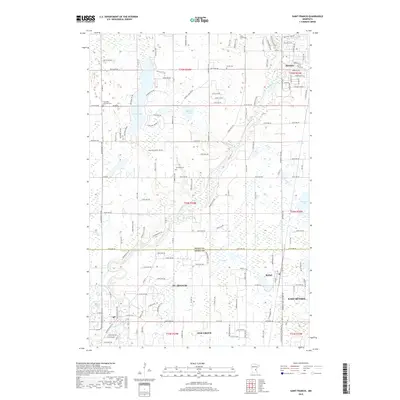
2019 Map of Saint Francis
USGS Topo · Published 2019About this map
The Rum River winds through this northern Anoka County landscape, marking a transition between the developing suburban fringes of St. Francis and East Bethel and the more open terrain of Isanti County to the north. This 2019 survey documents the modern layout of several small communities, including the city of Bethel and parts of Oak Grove. For local history researchers, the map identifies several well-established burial grounds that anchor the area's rural heritage, such as Long Lake Lutheran Cem and Stanford Cem. A high concentration of wetlands and water bodies defines the geography here, from the larger Long Lake and Marget Lake to the more secluded Smith Lake. The dense network of county roads and residential avenues illustrate the steady growth of this region as it integrates into the greater metropolitan periphery while maintaining its distinct river-valley character.
Find a feature on this map
148 named features on this map. Tap any name to fly to it.
Don’t see what you’re looking for? This feature index may not catch every label — zoom into the map to look around manually.
Map Details
Editions of this 2019 Saint Francis Map
This is the sole edition of this map. No revisions or reprints were ever made.
Other maps of this area

1916 · St. Francis
USGS Topo · 1:62,500

1919 · St. Francis
USGS Topo · 1:62,500

1953 · Stillwater
USGS Topo · 1:250,000

1955 · Isanti
USGS Topo · 1:62,500

1955 · Stillwater
USGS Topo · 1:250,000

1958 · Stillwater
USGS Topo · 1:250,000

1961 · Bradford
USGS Topo · 1:24,000

1961 · Cambridge
USGS Topo · 1:62,500

1961 · Wyanett
USGS Topo · 1:24,000

1961 · Dalbo
USGS Topo · 1:62,500