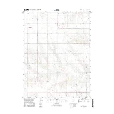
2015 Map of Saint Francis SW
USGS Topo · Published 2015About this map
The high plains of Cheyenne County are defined here by the winding course of Cherry Cr and the rhythmic grid of the Public Land Survey System. This landscape reflects the agrarian legacy of Western Kansas, where the township boundaries of t2s r41w, t2s r42w, t3s r41w, and t3s r42w provide the framework for a network of rural routes. Genealogists and local historians will find significant markers of the area's early community life, specifically the Salem Lutheran Cem and Salem Evangelical Cem, which stand as quiet testaments to the pioneer families and congregations that established these prairie outposts. The topographic detail illustrates the drainage patterns and subtle relief that shaped the settlement of this agricultural region.
Find a feature on this map
21 named features on this map. Tap any name to fly to it.
Don’t see what you’re looking for? This feature index may not catch every label — zoom into the map to look around manually.
Map Details
Editions of this 2015 Saint Francis SW Map
This is the sole edition of this map. No revisions or reprints were ever made.
Other maps of this area

1942 · St. Francis
USGS Topo · 1:62,500

1943 · St. Francis
USGS Topo · 1:62,500

1950 · Bonny Reservoir
USGS Topo · 1:62,500

1951 · St Francis
USGS Topo · 1:62,500

1952 · St Francis 3
USGS Topo · 1:62,500

1954 · Limon
USGS Topo · 1:250,000

1954 · Goodland
USGS Topo · 1:250,000

1956 · Goodland
USGS Topo · 1:250,000

1957 · Limon
USGS Topo · 1:250,000

1957 · Goodland
USGS Topo · 1:250,000