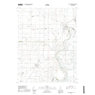
2018 Map of Saint Francisville
USGS Topo · Published 2018About this map
St. Francisville occupies a sharp bend in the river along the Illinois-Indiana border, serving as a focal point for this landscape where the Wabash River meanders through fertile lowlands and drainage networks. The area is defined by its complex water systems, including Big Slough, Raccoon Creek, and several ponds like Swan Pond and Wabash Pond that dominate the eastern portion of the quadrangle. Agricultural and rural heritage is evident in the numerous small family and community burial grounds dotting the countryside, such as the Stillwell Family Cem, Jordan Cem, and Armstrong Cem.
Find a feature on this map
86 named features on this map. Tap any name to fly to it.
Don’t see what you’re looking for? This feature index may not catch every label — zoom into the map to look around manually.
Map Details
Editions of this 2018 Saint Francisville Map
This is the sole edition of this map. No revisions or reprints were ever made.
Other maps of this area

1901 · Princeton
USGS Topo · 1:62,500

1903 · Princeton
USGS Topo · 1:62,500

1903 · Patoka
USGS Topo · 1:125,000

1904 · Mount Carmel
USGS Topo · 1:62,500

1911 · Sumner
USGS Topo · 1:62,500

1913 · Sumner
USGS Topo · 1:62,500

1915 · Vincennes
USGS Topo · 1:62,500

1944 · Vincennes
USGS Topo · 1:62,500

1956 · Vincennes
USGS Topo · 1:250,000

1957 · Vincennes
USGS Topo · 1:250,000