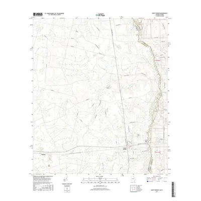
2017 Map of Saint George
USGS Topo · Published 2017About this map
Saint Marys River carves the winding state line between Georgia and Florida, defining the eastern edge of this landscape where the community of Saint George sits as a regional hub. The map reveals a dense network of local roads named for prominent families, including Pomp Crews Rd, Roy Sikes Rd, and Lushion Crews Rd, suggesting a landscape shaped by established agricultural and timber interests. To the west, the prominent geological feature of Trail Ridge rises above the lowlands, while numerous watercourses like Boone Cr and Mims Cr drain the surrounding terrain.
Find a feature on this map
74 named features on this map. Tap any name to fly to it.
Don’t see what you’re looking for? This feature index may not catch every label — zoom into the map to look around manually.
Map Details
Editions of this 2017 Saint George Map
This is the sole edition of this map. No revisions or reprints were ever made.
Other maps of this area

1917 · Cambon
USGS Topo · 1:62,500

1917 · Macclenny
USGS Topo · 1:62,500

1917 · Hilliard
USGS Topo · 1:62,500

1918 · Moniac
USGS Topo · 1:62,500

1918 · Cambon
USGS Topo · 1:62,500

1918 · Macclenny
USGS Topo · 1:62,500

1919 · Hilliard
USGS Topo · 1:62,500

1942 · Moniac
USGS Topo · 1:62,500

1948 · Jacksonville
USGS Topo · 1:250,000

1954 · Valdosta
USGS Topo · 1:250,000