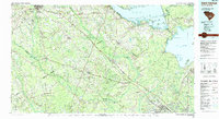
1990 Map of Saint George
USGS Topo · Published 1990About this map
The Santee River basin and the Lowcountry of South Carolina are captured here during the 1990s, showcasing a landscape defined by expansive wetlands and major hydroelectric impoundments. The geography is anchored by the massive waters of Lake Marion and Lake Moultrie, connected via the Ditch and the industrial Tailrace Canal near Moncks Corner. Between these reservoirs and the Edisto River to the south lies a network of significant blackwater systems, most notably the wide corridor of Four Hole Swamp and Wassamassaw Swamp.
Find a feature on this map
96 named features on this map. Tap any name to fly to it.
Don’t see what you’re looking for? This feature index may not catch every label — zoom into the map to look around manually.
Map Details
Editions of this 1990 Saint George Map
This is the sole edition of this map. No revisions or reprints were ever made.
Other maps of this area

1918 · Walterboro
USGS Topo · 1:62,500

1918 · Varnville
USGS Topo · 1:62,500

1918 · Cottageville
USGS Topo · 1:62,500

1919 · Ladson
USGS Topo · 1:21,120

1919 · Summerville
USGS Topo · 1:48,000

1919 · Olar
USGS Topo · 1:62,500

1919 · Ridgeville
USGS Topo · 1:48,000

1919 · Cordesville
USGS Topo · 1:48,000

1919 · Melgrove
USGS Topo · 1:21,120

1919 · Bamberg
USGS Topo · 1:48,000