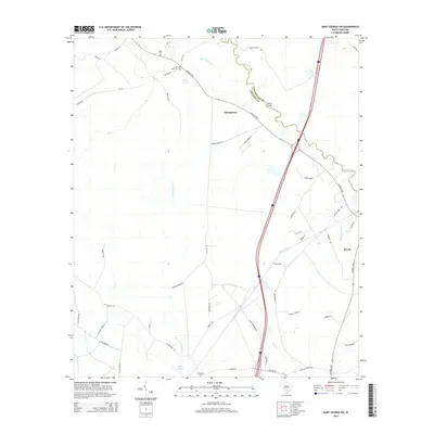
2014 Map of Saint George SW
USGS Topo · Published 2014About this map
Springtown and Weeks occupy this landscape along the Lowcountry border of Dorchester and Colleton counties. The Edisto River meanders through the northern reaches of the quadrangle, serving as a primary drainage for local tributaries like Brickhouse Br and Allen Cr. The area is characterized by several small water bodies and wetlands, including Green Pond and Cokers Pond, which reflect the region's low-lying hydrology. Genealogy researchers will find significant value in the distribution of family and community burial grounds, such as Spell Cem, Green Pond Cem, and Mt Carmel Cem. A dense network of local roads like Augusta Hwy, Jefferies Hwy, and Powder Horn Rd connect these rural settlements, showing the modern footprint of these historic South Carolina communities.
Find a feature on this map
49 named features on this map. Tap any name to fly to it.
Don’t see what you’re looking for? This feature index may not catch every label — zoom into the map to look around manually.
Map Details
Editions of this 2014 Saint George SW Map
This is the sole edition of this map. No revisions or reprints were ever made.
Other maps of this area

1918 · Walterboro
USGS Topo · 1:62,500

1919 · Cummings
USGS Topo · 1:62,500

1919 · Lodge
USGS Topo · 1:62,500

1920 · Lodge
USGS Topo · 1:48,000

1920 · St. George
USGS Topo · 1:48,000

1921 · Lodge
USGS Topo · 1:62,500

1921 · St. George
USGS Topo · 1:62,500

1943 · Lodge
USGS Topo · 1:62,500

1943 · Orangeburg
USGS Topo · 1:125,000

1943 · Cummings
USGS Topo · 1:62,500