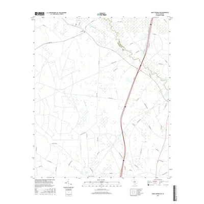
2017 Map of Saint George SW
USGS Topo · Published 2017About this map
The Edisto River meanders across the boundary of Dorchester Co and Colleton Co, defining the low-lying, wetland-rich geography of this South Carolina landscape. Historical crossing points like Raysor Bridge and small water bodies such as Cokers Pond anchor the rural infrastructure of the region. The map reflects a landscape of managed timberlands and drainage systems, indicated by names like Redbank Drain and Tree Farm Rd. Genealogists will find particular value in the distribution of family-named burial sites, including Spell Cem, Green Pond Cem, and Mount Carmel Cem, which serve as quiet markers of the long-established agricultural communities near Jones Swamp Cr and Allen Cr. The extensive network of local roads, such as Can City Rd and Powder Horn Rd, illustrates the modern connectivity woven through these traditional drainage basins.
Find a feature on this map
54 named features on this map. Tap any name to fly to it.
Don’t see what you’re looking for? This feature index may not catch every label — zoom into the map to look around manually.
Map Details
Editions of this 2017 Saint George SW Map
This is the sole edition of this map. No revisions or reprints were ever made.
Other maps of this area

1918 · Walterboro
USGS Topo · 1:62,500

1919 · Cummings
USGS Topo · 1:62,500

1919 · Lodge
USGS Topo · 1:62,500

1920 · Lodge
USGS Topo · 1:48,000

1920 · St. George
USGS Topo · 1:48,000

1921 · Lodge
USGS Topo · 1:62,500

1921 · St. George
USGS Topo · 1:62,500

1943 · Lodge
USGS Topo · 1:62,500

1943 · Orangeburg
USGS Topo · 1:125,000

1943 · Cummings
USGS Topo · 1:62,500