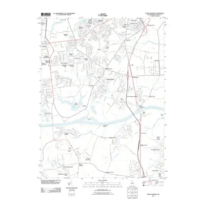
2011 Map of Saint Georges
USGS Topo · Published 2011About this map
The Chesapeake and Delaware Canal bisects this New Castle County landscape, serving as a primary navigational artery between the Delaware River and Chesapeake Bay. On the northern banks, the community of Kirkwood and the expansion of Glasgow define the suburban character of the region, while the Canal Bridge provides a critical link for land transport. Large-scale preservation and memorial sites are prominent, including the Delaware Veterans Memorial Cemetery near the shores of Lums Pond.
Find a feature on this map
90 named features on this map. Tap any name to fly to it.
Don’t see what you’re looking for? This feature index may not catch every label — zoom into the map to look around manually.
Map Details
Editions of this 2011 Saint Georges Map
This is the sole edition of this map. No revisions or reprints were ever made.
Other maps of this area

1898 · Elkton
USGS Topo · 1:62,500

1899 · Dover
USGS Topo · 1:125,000

1900 · Elkton
USGS Topo · 1:62,500

1900 · Cecilton
USGS Topo · 1:62,500

1904 · Wilmington
USGS Topo · 1:62,500

1906 · Dover
USGS Topo · 1:125,000

1906 · Wilmington
USGS Topo · 1:62,500

1917 · Elkton
USGS Topo · 1:62,500

1919 · Wilmington
USGS Topo · 1:62,500

1920 · Dover
USGS Topo · 1:125,000
Featured Places
- Dragon Run Terrace Mobile Home Park, DE
- Hickory Woods, DE
- Melody Meadows II, DE
- Tybouts Corner, DE
- Belltown Woods, DE