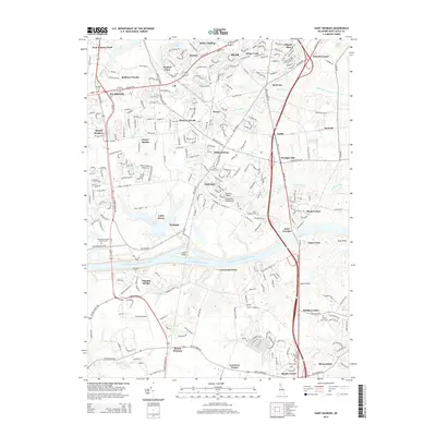
2014 Map of Saint Georges
USGS Topo · Published 2014About this map
The Chesapeake and Delaware Canal serves as the dominant east-west axis for this New Castle County landscape, forming part of the critical Intracoastal Waterway network. North of the canal, the settlement pattern shows a dense mix of established communities like Glasgow, Red Lion, and Saint Georges, which are interspersed with newer developments such as Four Seasons Park and Belltown Woods. This proximity of historic crossroads to suburban growth reflects the modern evolution of the Delmarva Peninsula. Local history is deeply etched into the land via several burial grounds, including the Delaware Veterans Memorial Cem and the Pencader Cem. Transport infrastructure beyond the canal is marked by the Summit Airport and the massive Canal Bridge spanning the water, while natural drainage is managed by systems like Dragon Creek and Lums Pond.
Find a feature on this map
70 named features on this map. Tap any name to fly to it.
Don’t see what you’re looking for? This feature index may not catch every label — zoom into the map to look around manually.
Map Details
Editions of this 2014 Saint Georges Map
This is the sole edition of this map. No revisions or reprints were ever made.
Other maps of this area

1898 · Elkton
USGS Topo · 1:62,500

1899 · Dover
USGS Topo · 1:125,000

1900 · Elkton
USGS Topo · 1:62,500

1900 · Cecilton
USGS Topo · 1:62,500

1904 · Wilmington
USGS Topo · 1:62,500

1906 · Dover
USGS Topo · 1:125,000

1906 · Wilmington
USGS Topo · 1:62,500

1917 · Elkton
USGS Topo · 1:62,500

1919 · Wilmington
USGS Topo · 1:62,500

1920 · Dover
USGS Topo · 1:125,000
Featured Places
- Dragon Run Terrace Mobile Home Park, DE
- Hickory Woods, DE
- Melody Meadows II, DE
- Tybouts Corner, DE
- Belltown Woods, DE