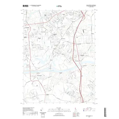
2019 Map of Saint Georges
USGS Topo · Published 2019About this map
The Chesapeake and Delaware Canal serves as the dominant structural feature of this landscape, cutting across the Delmarva Peninsula and forming part of the Intracoastal Waterway. The massive Canal Bridge at Summit Bridge facilitates north-south travel over this maritime artery, which historically linked the Chesapeake Bay and Delaware River watersheds. The surrounding terrain is a patchwork of established communities like St. Georges and emerging residential developments such as Wrange Hill Estates and Caravel Farms.
Find a feature on this map
261 named features on this map. Tap any name to fly to it.
Don’t see what you’re looking for? This feature index may not catch every label — zoom into the map to look around manually.
Map Details
Editions of this 2019 Saint Georges Map
This is the sole edition of this map. No revisions or reprints were ever made.
Other maps of this area

1898 · Elkton
USGS Topo · 1:62,500

1899 · Dover
USGS Topo · 1:125,000

1900 · Elkton
USGS Topo · 1:62,500

1900 · Cecilton
USGS Topo · 1:62,500

1904 · Wilmington
USGS Topo · 1:62,500

1906 · Dover
USGS Topo · 1:125,000

1906 · Wilmington
USGS Topo · 1:62,500

1917 · Elkton
USGS Topo · 1:62,500
1919 · Wilmington
USGS Topo · 1:62,500

1920 · Dover
USGS Topo · 1:125,000
Featured Places
- Dragon Run Terrace Mobile Home Park, DE
- Hickory Woods, DE
- Melody Meadows II, DE
- Tybouts Corner, DE
- Belltown Woods, DE