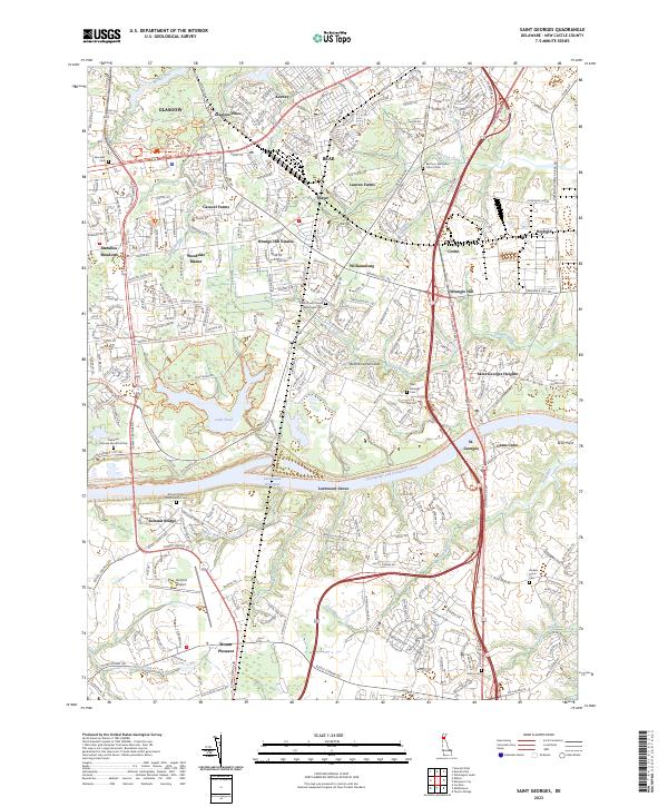
2023 Map of Saint Georges
USGS Topo · Published 2023About this map
The Chesapeake and Delaware Canal serves as the dominant industrial artery of this landscape, cutting through the northern Delmarva Peninsula to connect regional waterways. This modern geography highlights the evolution of the area from rural crossings to a suburban corridor, where the historic settlement of St. Georges is bisected by the massive waterway. Extensive trail systems, including the Michael Castle Trl and Swamp Forest Trl, demonstrate the transition of former wilderness and marshland into managed recreational spaces like Lums Pond.
Find a feature on this map
61 named features on this map. Tap any name to fly to it.
Don’t see what you’re looking for? This feature index may not catch every label — zoom into the map to look around manually.
Map Details
Editions of this 2023 Saint Georges Map
This is the sole edition of this map. No revisions or reprints were ever made.
Other maps of this area

1898 · Elkton
USGS Topo · 1:62,500

1899 · Dover
USGS Topo · 1:125,000

1900 · Elkton
USGS Topo · 1:62,500

1900 · Cecilton
USGS Topo · 1:62,500

1904 · Wilmington
USGS Topo · 1:62,500

1906 · Dover
USGS Topo · 1:125,000

1906 · Wilmington
USGS Topo · 1:62,500

1917 · Elkton
USGS Topo · 1:62,500

1919 · Wilmington
USGS Topo · 1:62,500

1920 · Dover
USGS Topo · 1:125,000
Featured Places
- Four Seasons Park, DE
- Dragon Run Terrace Mobile Home Park, DE
- Hickory Woods, DE
- Melody Meadows II, DE
- Tybouts Corner, DE