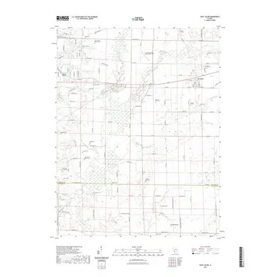
2021 Map of Saint Jacob
USGS Topo · Published 2021About this map
Silver Creek and its many tributaries, including E Fork Silver Creek and Little Silver Creek, define the drainage patterns across this Madison County landscape. The area is characterized by a dense concentration of family and community burial sites, suggesting a long history of local settlement and genealogical importance. Notable locations include the Smart Family Burial Ground, Keystone City Cemetery, and Augusta Cemetery. To the south, the terrain is marked by Emerald Mound near the border with St. Clair County. Small-town centers such as Troy and St. Jacob anchor the region, while the St Louis Metro-East Airport/Shafer Field represents modern infrastructure. Numerous minor waterways like Wendell Branch and North Fork Mill Creek illustrate the intricate creek systems that historically dictated land use and property boundaries.
Find a feature on this map
112 named features on this map. Tap any name to fly to it.
Don’t see what you’re looking for? This feature index may not catch every label — zoom into the map to look around manually.
Map Details
Editions of this 2021 Saint Jacob Map
This is the sole edition of this map. No revisions or reprints were ever made.
Other maps of this area

1906 · Breese
USGS Topo · 1:62,500

1907 · Breese
USGS Topo · 1:62,500

1907 · Belleville
USGS Topo · 1:62,500

1927 · Edwardsville
USGS Topo · 1:62,500

1932 · Edwardsville
USGS Topo · 1:62,500

1935 · Lebanon
USGS Topo · 1:24,000

1937 · Collinsville
USGS Topo · 1:24,000

1937 · O'Fallon
USGS Topo · 1:24,000

1937 · New Douglas
USGS Topo · 1:48,000

1944 · New Douglas
USGS Topo · 1:62,500