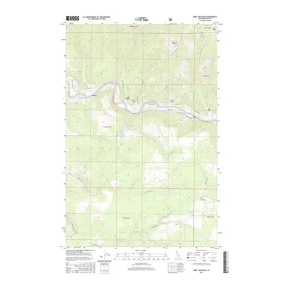
2017 Map of Saint Joe Baldy
USGS Topo · Published 2017About this map
The Saint Joe River dominates this portion of Benewah County, cutting an east-west path through a landscape defined by significant elevation changes between Saint Joe Baldy and the river valley. The settlement at Omega sits along the Railroad Grade Rd, reflecting the historical transport corridor that followed the river's northern bank. This 2017 survey details the complex network of forest access routes, including the St Joe River Rd and W Riverside Dr, which serve the high country and meadows like Hnmiln Meadow. The topography is marked by numerous drainage features such as Rochat Cr and Mercury Cr, which flow from the northern peaks toward the main river channel. Smaller landmarks like Turtle Lake and the high-altitude Reeds Baldy provide a clear picture of the timber and recreation-oriented geography of northern Idaho in the early 21st century.
Find a feature on this map
40 named features on this map. Tap any name to fly to it.
Don’t see what you’re looking for? This feature index may not catch every label — zoom into the map to look around manually.
Map Details
Editions of this 2017 Saint Joe Baldy Map
This is the sole edition of this map. No revisions or reprints were ever made.
Other maps of this area

1950 · Rochat Peak
USGS Topo · 1:24,000

1950 · Twin Crags
USGS Topo · 1:24,000

1952 · Rochat Peak
USGS Topo · 1:24,000

1952 · Twin Crags
USGS Topo · 1:24,000

1955 · Spokane
USGS Topo · 1:250,000

1957 · St. Maries
USGS Topo · 1:62,500

1957 · Emida
USGS Topo · 1:62,500

1957 · St. Joe
USGS Topo · 1:62,500

1958 · Spokane
USGS Topo · 1:250,000

1961 · Fernwood
USGS Topo · 1:62,500