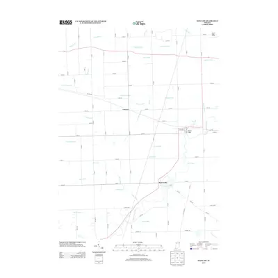
2013 Map of Saint Joe
USGS Topo · Published 2013About this map
The Saint Joseph River meanders through this portion of DeKalb County, anchoring the small communities of Saint Joe and Spencerville. The landscape is defined by an extensive and intricate network of agricultural drainage systems, including the Sol Shank Ditch, Wingard Ditch, and Metcalf Ditch, which illustrate the managed hydrology of Indiana’s till plains. Further north, the settlement of Concord sits at a crossroads, while the Greuter Field Airport occupies the northeastern corner of the map. Traces of the region's earlier infrastructure are preserved in names like Old Brick Rd, providing a contrast to the modern county road grid. Smaller waterways such as Bear Cr and Wade Ditch feed into the primary river valley, marking the subtle elevation changes of the local terrain.
Find a feature on this map
65 named features on this map. Tap any name to fly to it.
Don’t see what you’re looking for? This feature index may not catch every label — zoom into the map to look around manually.
Map Details
Editions of this 2013 Saint Joe Map
This is the sole edition of this map. No revisions or reprints were ever made.
Other maps of this area

1953 · Fort Wayne
USGS Topo · 1:250,000

1956 · Fort Wayne
USGS Topo · 1:250,000

1956 · Cedarville
USGS Topo · 1:24,000

1957 · Auburn
USGS Topo · 1:24,000

1957 · Waterloo
USGS Topo · 1:24,000

1958 · Hicksville
USGS Topo · 1:24,000

1958 · Grabill
USGS Topo · 1:24,000

1958 · Butler West
USGS Topo · 1:24,000

1958 · Woodburn North
USGS Topo · 1:24,000
1958 · Saint Joe
USGS Topo · 1:24,000