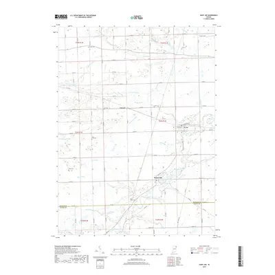
2019 Map of Saint Joe
USGS Topo · Published 2019About this map
The Saint Joseph River winds through the eastern half of this DeKalb County landscape, anchoring the riverside settlements of St. Joe and Spencerville. This agricultural region is meticulously divided by a network of county roads and drainage systems, including N Br Hursey Ditch and Sebert Ditch, which support the low-lying farmland. Local heritage is preserved in numerous family-named burial grounds dotting the townships, such as Riverside Cem, White City Cem, and the small Cosper Cem near the northern boundary. The community of Concord serves as another focal point, situated at a crossroad among these drainage basins. This detailed survey provides a clear view of the rural infrastructure and the many named waterways that have long shaped the settlement patterns of northeastern Indiana.
Find a feature on this map
79 named features on this map. Tap any name to fly to it.
Don’t see what you’re looking for? This feature index may not catch every label — zoom into the map to look around manually.
Map Details
Editions of this 2019 Saint Joe Map
This is the sole edition of this map. No revisions or reprints were ever made.
Other maps of this area

1953 · Fort Wayne
USGS Topo · 1:250,000

1956 · Fort Wayne
USGS Topo · 1:250,000

1956 · Cedarville
USGS Topo · 1:24,000

1957 · Auburn
USGS Topo · 1:24,000

1957 · Waterloo
USGS Topo · 1:24,000

1958 · Hicksville
USGS Topo · 1:24,000

1958 · Grabill
USGS Topo · 1:24,000

1958 · Butler West
USGS Topo · 1:24,000

1958 · Woodburn North
USGS Topo · 1:24,000
1958 · Saint Joe
USGS Topo · 1:24,000