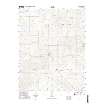
2017 Map of Saint Joe
USGS Topo · Published 2017About this map
Saint Joe and Pindall anchor this portion of the Ozark landscape in Searcy and Marion Counties, where high ridges and deeply cut hollows dictate the layout of roads and settlements. The terrain is defined by prominent elevations such as Davy Crockett Mtn and Pilot Mtn, while the drainage patterns of Tomahawk Cr and Clear Cr carve out the valleys. For genealogists, the map is particularly useful for locating several small community burial grounds, including Anderson Flat Cem, Henley Cem, and Abbey Cem. Historically smaller locales such as Verona and Duff appear along the local road networks, illustrating the dispersed rural settlement pattern common to this area of northern Arkansas. The topography here transition between the steep peaks like Saint Joe Mtn and the broader plateaus of Ham Flat and Anderson Flat.
Find a feature on this map
87 named features on this map. Tap any name to fly to it.
Don’t see what you’re looking for? This feature index may not catch every label — zoom into the map to look around manually.
Map Details
Editions of this 2017 Saint Joe Map
This is the sole edition of this map. No revisions or reprints were ever made.
Other maps of this area

1892 · Marshall
USGS Topo · 1:125,000

1893 · Yellville
USGS Topo · 1:125,000

1894 · Marshall
USGS Topo · 1:125,000

1901 · Marshall
USGS Topo · 1:125,000

1903 · Yellville
USGS Topo · 1:125,000

1905 · Yellville
USGS Topo · 1:125,000

1929 · Yellville
USGS Topo · 1:125,000

1939 · Snowball
USGS Topo · 1:62,500

1941 · Snowball
USGS Topo · 1:62,500

1942 · Snowball
USGS Topo · 1:62,500