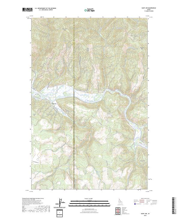
2024 Map of Saint Joe
USGS Topo · Published 2024About this map
The Saint Joe Wild and Scenic River carves through the heart of the St Joe Mountains, defining the geography and history of this northern Idaho corridor. Along its banks, the settlement of Saint Joe sits near the confluence of Bond Creek and the river, reflecting a landscape shaped by both natural waterways and early 20th-century transportation. The map reveals the path of the Old Milwaukee Road RR Grade, a significant relic of transcontinental rail history that follows the northern shore of Urquhart Lake and passes through Whitetail Flats. To the north, the terrain rises sharply toward Honey Jones Peak and the Honey Jones Ridge, while the eastern portion of the quadrangle is dominated by the peaks and draws surrounding Fitzgerald Peak. This modern survey by the U.S. Geological Survey documents the enduring imprint of the Milwaukee Road and the complex drainage systems of Falls Creek and Mineral Creek in Shoshone County.
Find a feature on this map
54 named features on this map. Tap any name to fly to it.
Don’t see what you’re looking for? This feature index may not catch every label — zoom into the map to look around manually.
Map Details
Editions of this 2024 Saint Joe Map
This is the sole edition of this map. No revisions or reprints were ever made.
Other maps of this area

1950 · Rochat Peak
USGS Topo · 1:24,000

1950 · Twin Crags
USGS Topo · 1:24,000

1952 · Rochat Peak
USGS Topo · 1:24,000

1952 · Twin Crags
USGS Topo · 1:24,000

1955 · Spokane
USGS Topo · 1:250,000

1957 · Calder
USGS Topo · 1:62,500

1957 · St. Joe
USGS Topo · 1:62,500

1958 · Spokane
USGS Topo · 1:250,000

1961 · Fernwood
USGS Topo · 1:62,500

1969 · Huckleberry Mtn
USGS Topo · 1:24,000