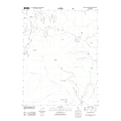
2012 Map of Saint John Mountain
USGS Topo · Published 2012About this map
Saint John Mountain dominates this portion of the Mendocino National Forest, serving as a high point between the drainages of the Middle Fork Stony Cr and N Fork Stony Cr. The 2012 topography shows a landscape defined by forest service routes and remote outposts like Brittan Ranch and Meyers Cabin. These structures, along with the Bonnie View settlement and the Happy Camp landing, suggest a history of seasonal residence and ranching within the canyons.
Find a feature on this map
35 named features on this map. Tap any name to fly to it.
Don’t see what you’re looking for? This feature index may not catch every label — zoom into the map to look around manually.
Map Details
Editions of this 2012 Saint John Mountain Map
This is the sole edition of this map. No revisions or reprints were ever made.
Other maps of this area

1919 · Elk Creek
USGS Topo · 1:62,500

1922 · Hullville
USGS Topo · 1:62,500

1948 · Elk Creek
USGS Topo · 1:62,500

1951 · Lake Pillsbury
USGS Topo · 1:62,500

1951 · Stonyford
USGS Topo · 1:62,500

1952 · Hull Mountain
USGS Topo · 1:62,500

1957 · Elk Creek
USGS Topo · 1:62,500

1957 · Ukiah
USGS Topo · 1:250,000

1960 · Ukiah
USGS Topo · 1:250,000
1967 · Potato Hill
USGS Topo · 1:24,000