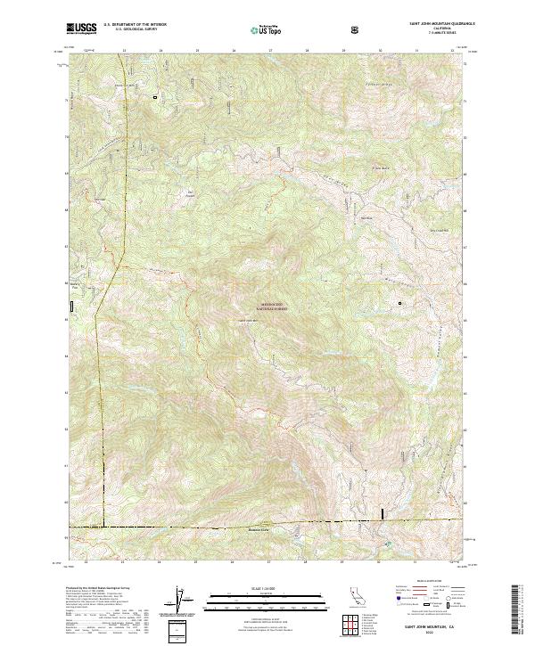
2022 Map of Saint John Mountain
USGS Topo · Published 2022About this map
Mendocino National Forest encompasses the high, ridged landscape of the inner Coast Range, where the triple-point intersection of Lake, Glenn, and Colusa counties meets. The terrain is defined by dramatic elevation changes between Saint John Mtn and the deep drainage of the Middle Fork Stony Cr. These watercourses, including N Fork Stony Cr and Dark Hollow Cr, establish the primary geographic grain of the territory, carving through prominent features like Felkner Ridge and Black Diamond Ridge.
Find a feature on this map
44 named features on this map. Tap any name to fly to it.
Don’t see what you’re looking for? This feature index may not catch every label — zoom into the map to look around manually.
Map Details
Editions of this 2022 Saint John Mountain Map
This is the sole edition of this map. No revisions or reprints were ever made.
Other maps of this area

1919 · Elk Creek
USGS Topo · 1:62,500

1922 · Hullville
USGS Topo · 1:62,500

1948 · Elk Creek
USGS Topo · 1:62,500

1951 · Lake Pillsbury
USGS Topo · 1:62,500

1951 · Stonyford
USGS Topo · 1:62,500

1952 · Hull Mountain
USGS Topo · 1:62,500

1957 · Elk Creek
USGS Topo · 1:62,500

1957 · Ukiah
USGS Topo · 1:250,000

1960 · Ukiah
USGS Topo · 1:250,000
1967 · Potato Hill
USGS Topo · 1:24,000