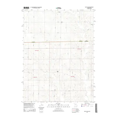
2014 Map of Saint John
USGS Topo · Published 2014About this map
Saint John serves as the central focal point for this rural landscape where the Iowa Missouri state line meets the boundary between Wayne and Putnam Counties. The terrain is defined by the dendritic drainage patterns of Locust Creek and the West Fork Locust Creek, which carve through the countryside alongside smaller tributaries like Elm Branch. The distribution of family and community burial sites, including Harris Cemetery, Pleasant View Cemetery, Genoa Cemetery, and Torrey Cemetery, suggests a long-standing pattern of dispersed agricultural settlement. A grid of section-line roads such as Davis Road and 150th Street provides access to the interior, while more modern paths like Gray Pine Trail and Grand Fir Trail weave through the hillsides, reflecting the continued navigation of this borderland region.
Find a feature on this map
24 named features on this map. Tap any name to fly to it.
Don’t see what you’re looking for? This feature index may not catch every label — zoom into the map to look around manually.
Map Details
Editions of this 2014 Saint John Map
This is the sole edition of this map. No revisions or reprints were ever made.
Other maps of this area

1942 · Seymour
USGS Topo · 1:62,500

1944 · Seymour
USGS Topo · 1:62,500

1954 · Centerville
USGS Topo · 1:250,000

1957 · Centerville
USGS Topo · 1:250,000

1958 · Centerville
USGS Topo · 1:250,000

1964 · Pollock NW
USGS Topo · 1:24,000

1964 · Unionville West
USGS Topo · 1:24,000

1964 · Lucerne
USGS Topo · 1:24,000

1964 · Allerton
USGS Topo · 1:24,000
1964 · Powersville
USGS Topo · 1:24,000