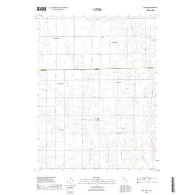
2017 Map of Saint John
USGS Topo · Published 2017About this map
Saint John sits at the heart of this North Central Missouri landscape, where the Iowa Missouri state line and the border of Wayne Co and Putnam Co converge. The terrain is defined by the drainage of Locust Cr and its W Fork Locust Cr, which carve through a network of rural roads such as Cedar and Birch. This area retains its agrarian character, marked by a scattering of small family and community burial grounds including Harris Cem, Pleasant View Cem, Genoa Cem, and Torrey Cem. The map illustrates the persistent 19th-century township-and-range survey grid, overlaid with more recent state routes like State Hwy T and State Hwy E. For those researching regional history, these features reveal the enduring footprint of early Missouri settlements and the geographic boundaries that have shaped local administration for generations.
Find a feature on this map
42 named features on this map. Tap any name to fly to it.
Don’t see what you’re looking for? This feature index may not catch every label — zoom into the map to look around manually.
Map Details
Editions of this 2017 Saint John Map
This is the sole edition of this map. No revisions or reprints were ever made.
Other maps of this area

1942 · Seymour
USGS Topo · 1:62,500

1944 · Seymour
USGS Topo · 1:62,500

1954 · Centerville
USGS Topo · 1:250,000

1957 · Centerville
USGS Topo · 1:250,000

1958 · Centerville
USGS Topo · 1:250,000

1964 · Pollock NW
USGS Topo · 1:24,000

1964 · Unionville West
USGS Topo · 1:24,000

1964 · Lucerne
USGS Topo · 1:24,000

1964 · Allerton
USGS Topo · 1:24,000
1964 · Powersville
USGS Topo · 1:24,000