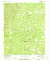
1968 Map of Saint Joy
USGS Topo · Published 1971About this map
The settlement of Saint Joy anchors this 1968 survey of Buckingham County, Virginia, a landscape defined by its network of rural congregations and upland watercourses. Small community centers like Mathews and Woods Corner are mapped alongside a high density of country churches, including Antioch Ch, Union Hill Ch, and Maple Grove Ch, many with adjacent burial grounds. These features illustrate the decentralized social structure of the Piedmont region in the mid-20th century.
Find a feature on this map
28 named features on this map. Tap any name to fly to it.
Don’t see what you’re looking for? This feature index may not catch every label — zoom into the map to look around manually.
Map Details
Editions of this 1968 Saint Joy Map
2 editions found
Other maps of this area

1892 · Buckingham
USGS Topo · 1:125,000

1892 · Appomattox
USGS Topo · 1:125,000

1947 · Roanoke
USGS Topo · 1:250,000

1958 · Appomattox
USGS Topo · 1:62,500

1958 · Pamplin City
USGS Topo · 1:62,500

1959 · Roanoke
USGS Topo · 1:250,000

1961 · Shipman
USGS Topo · 1:62,500

1961 · Buckingham
USGS Topo · 1:62,500

1963 · Roanoke
USGS Topo · 1:250,000

1967 · Andersonville
USGS Topo · 1:24,000