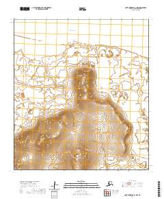
2020 Map of Saint Lawrence B-1 NW
USGS Topo · Published 2020About this map
The Bering Sea coastline of Saint Lawrence Island defines this remote coastal landscape, where the tides meet the northern reaches of the Seepanpak Inlet. The terrain is dominated by isolated peaks including Tomname Mtn and the prominent Gudrum Mtn to the east. These coastal heights overlook a shoreline shaped by Tomname Point and the adjacent Nivalghat Beach, offering a detailed look at the island's geomorphology as it was recorded in 2020. The southern portion of the quadrangle rises toward Soomaghat Mtn, illustrating the dramatic transition from the sea to the high ridgelines that characterize this subarctic environment. This U.S. Geological Survey representation focuses on the natural topography and hydrologic features, providing a clear reference for the uninhabited stretches between the island's maritime boundaries and its interior elevations.
Find a feature on this map
12 named features on this map. Tap any name to fly to it.
Don’t see what you’re looking for? This feature index may not catch every label — zoom into the map to look around manually.
Map Details
Editions of this 2020 Saint Lawrence B-1 NW Map
This is the sole edition of this map. No revisions or reprints were ever made.
Other maps of this area

1948 · St Lawrence
USGS Topo · 1:250,000

1949 · St Lawrence
USGS Topo · 1:250,000

1964 · St Lawrence
USGS Topo · 1:250,000
2020 · Saint Lawrence B-1 SE
USGS Topo · 1:25,000
2020 · Saint Lawrence B-1 SW
USGS Topo · 1:25,000
2020 · Saint Lawrence B-2 SE
USGS Topo · 1:25,000
2020 · Saint Lawrence C-2 SE
USGS Topo · 1:25,000
2020 · Saint Lawrence B-1 NE
USGS Topo · 1:25,000
2020 · Saint Lawrence B-2 NE
USGS Topo · 1:25,000