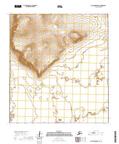
2020 Map of Saint Lawrence B-2 SE
USGS Topo · Published 2020About this map
Myghapowit Mtn dominates the northwestern terrain of this isolated portion of Saint Lawrence Island, rising above the surrounding coastal lowlands. This 2020 edition reveals a landscape defined by sharp elevation shifts in the north that give way to an expansive, feature-sparse southern plain marked by township boundaries for t26s r58w, t26s r57w, t27s r58w, and t27s r57w. The absence of roads or settlements underscores the remote character of this Bering Sea environment, making it an essential reference for understanding the physical geography and administrative division of the Nome Census Area.
Find a feature on this map
5 named features on this map. Tap any name to fly to it.
Don’t see what you’re looking for? This feature index may not catch every label — zoom into the map to look around manually.
Map Details
Editions of this 2020 Saint Lawrence B-2 SE Map
This is the sole edition of this map. No revisions or reprints were ever made.
Other maps of this area

1948 · St Lawrence
USGS Topo · 1:250,000

1949 · St Lawrence
USGS Topo · 1:250,000

1964 · St Lawrence
USGS Topo · 1:250,000
2020 · Saint Lawrence A-2 NE
USGS Topo · 1:25,000
2020 · Saint Lawrence B-2 NW
USGS Topo · 1:25,000
2020 · Saint Lawrence B-1 SW
USGS Topo · 1:25,000
2020 · Saint Lawrence A-2 NW
USGS Topo · 1:25,000
2020 · Saint Lawrence A-1 NW
USGS Topo · 1:25,000
2020 · Saint Lawrence B-2 SW
USGS Topo · 1:25,000
2020 · Saint Lawrence B-1 NW
USGS Topo · 1:25,000