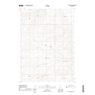
2017 Map of Saint Lawrence Basin
USGS Topo · Published 2017About this map
Saint Lawrence Basin and its surrounding peaks define this portion of the Wind River Range within Fremont County. The high-altitude landscape is marked by prominent summits like Bear Peak and Little Horse Peak, which overlook a complex network of headwaters including N Fork Sage Cr and Saint Lawrence Cr. A notable transition in the terrain occurs at The Meadows, where the topography softens amidst the steeper slopes of Saint Lawrence Ridge. Human infrastructure is sparse in this 2017 survey, limited primarily to the Saint Lawrence Ranger Station Rd, which provides access to the area's interior. This map records the hydrography of the region's diverse drainage systems, such as the N Fork Little Wind River and Washakie Cr, documenting a wilderness environment largely shaped by natural water sources like Wild Horse Spring.
Find a feature on this map
22 named features on this map. Tap any name to fly to it.
Don’t see what you’re looking for? This feature index may not catch every label — zoom into the map to look around manually.
Map Details
Editions of this 2017 Saint Lawrence Basin Map
This is the sole edition of this map. No revisions or reprints were ever made.
Other maps of this area

1937 · Moccasin Lake
USGS Topo · 1:48,000

1938 · Mt Bonneville
USGS Topo · 1:62,500

1941 · Mt Bonneville
USGS Topo · 1:62,500

1942 · Mt Bonneville
USGS Topo · 1:62,500

1943 · Moccasin Lake
USGS Topo · 1:62,500

1951 · Bull Lake East
USGS Topo · 1:24,000

1952 · Wise Flat
USGS Topo · 1:24,000

1952 · Bull Lake West
USGS Topo · 1:24,000

1952 · Kirkland Park
USGS Topo · 1:24,000

1952 · Paradise Basin
USGS Topo · 1:24,000