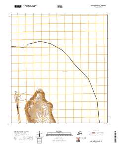
2020 Map of Saint Lawrence D-6 NE
USGS Topo · Published 2020About this map
Gambell sits at the northwestern edge of St. Lawrence Island, positioned where the land meets the vast Bering Sea. This coastal settlement is defined by its proximity to Northwest Cape and the rugged topography of the nearby heights. The landscape rises sharply from the shore into a series of prominent peaks, including Sevuokuk Mtn, Sevooghak Mtn, and Marukta Mtn, which dominate the interior terrain just east of the village.
Find a feature on this map
14 named features on this map. Tap any name to fly to it.
Don’t see what you’re looking for? This feature index may not catch every label — zoom into the map to look around manually.
Map Details
Editions of this 2020 Saint Lawrence D-6 NE Map
This is the sole edition of this map. No revisions or reprints were ever made.
Other maps of this area

1948 · St Lawrence
USGS Topo · 1:250,000

1949 · St Lawrence
USGS Topo · 1:250,000

1964 · St Lawrence
USGS Topo · 1:250,000

2020 · Saint Lawrence D-5 SW
USGS Topo · 1:25,000
2020 · Saint Lawrence D-6 SW
USGS Topo · 1:25,000
2020 · Saint Lawrence D-6 SE
USGS Topo · 1:25,000
2020 · Saint Lawrence D-6 NW
USGS Topo · 1:25,000