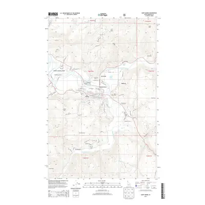
2013 Map of Saint Maries
USGS Topo · Published 2013About this map
St. Maries serves as the focal point of this northern Idaho landscape, situated at the confluence of the Saint Joe River and the Saint Maries River. The town's grid is well-defined, stretching from Saint Maries Ave down to Lincoln Ave, with the St. Maries Municipal Airport and Woodlawn Cem anchoring the western side of the community. The surrounding terrain is a complex network of ridges and drainages, featuring landmarks such as Kings Peak and the prominent Chat'u'washa'lqs Bluff overlooking the river valley.
Find a feature on this map
91 named features on this map. Tap any name to fly to it.
Don’t see what you’re looking for? This feature index may not catch every label — zoom into the map to look around manually.
Map Details
Editions of this 2013 Saint Maries Map
This is the sole edition of this map. No revisions or reprints were ever made.
Other maps of this area

1950 · Rochat Peak
USGS Topo · 1:24,000

1952 · Rochat Peak
USGS Topo · 1:24,000

1955 · Spokane
USGS Topo · 1:250,000

1957 · St. Maries
USGS Topo · 1:62,500

1957 · Emida
USGS Topo · 1:62,500

1957 · St. Joe
USGS Topo · 1:62,500

1958 · Spokane
USGS Topo · 1:250,000

1961 · Fernwood
USGS Topo · 1:62,500

1981 · St Maries
USGS Topo · 1:100,000
1981 · Medimont
USGS Topo · 1:24,000