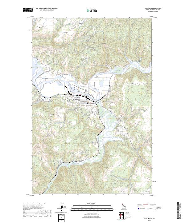
2024 Map of Saint Maries
USGS Topo · Published 2024About this map
St. Maries serves as the focal point of this region, situated at the confluence of the Saint Joe River and the Saint Maries River. This modern survey illustrates the town's administrative role as the county seat, clearly marking the Benewah County Courthouse and the local Woodlawn Cem. The landscape is defined by its dramatic elevation changes and water features, including the Saint Joe Wild and Scenic River corridor and nearby lakes such as Bells Lake and Swan Lake. The transport infrastructure includes the Jack A Buell Airport and a network of mountain roads like Garden Tracts Rd. Higher elevations are marked by distinctive landmarks including Kings Peak and Saint Maries Peak, while the river's path is punctuated by features such as itq'eykwe' Rapid. This map details the modern balance of a riverfront settlement and its surrounding timberlands.
Find a feature on this map
99 named features on this map. Tap any name to fly to it.
Don’t see what you’re looking for? This feature index may not catch every label — zoom into the map to look around manually.
Map Details
Editions of this 2024 Saint Maries Map
This is the sole edition of this map. No revisions or reprints were ever made.
Other maps of this area

1950 · Rochat Peak
USGS Topo · 1:24,000

1952 · Rochat Peak
USGS Topo · 1:24,000

1955 · Spokane
USGS Topo · 1:250,000

1957 · St. Maries
USGS Topo · 1:62,500

1957 · Emida
USGS Topo · 1:62,500

1957 · St. Joe
USGS Topo · 1:62,500

1958 · Spokane
USGS Topo · 1:250,000

1961 · Fernwood
USGS Topo · 1:62,500

1981 · St Maries
USGS Topo · 1:100,000
1981 · Medimont
USGS Topo · 1:24,000