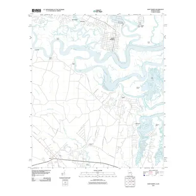
2011 Map of Saint Marys
USGS Topo · Published 2011About this map
The Saint Marys waterfront and the winding reaches of the Saint Marys River define this coastal landscape on the Georgia-Florida border. As of 2011, the area exhibits a transition from the structured grid of the historic town to the expanding residential pockets of Yulee and Glenwood. The intricate hydrography of the region is evident in the sprawling marshes around Tiger Island and the confluence of the North River, Bells River, and Jolly River. Local heritage is anchored by sites like the Higginbotham Cemetery and Yulee Cemetery, while the river geography is marked by distinctive landings and bluffs, including Millers Bluff, Reids Bluff, and Roses Bluff. This survey also documents the St Marys Cumberland Island area, illustrating the relationship between the mainland settlements and the protected coastal environment.
Find a feature on this map
55 named features on this map. Tap any name to fly to it.
Don’t see what you’re looking for? This feature index may not catch every label — zoom into the map to look around manually.
Map Details
Editions of this 2011 Saint Marys Map
This is the sole edition of this map. No revisions or reprints were ever made.
Other maps of this area

1918 · St Marys
USGS Topo · 1:62,500

1918 · Cumberland Island
USGS Topo · 1:62,500

1918 · Kingsland
USGS Topo · 1:62,500

1919 · Fernandina
USGS Topo · 1:62,500

1919 · St Marys
USGS Topo · 1:62,500

1930 · Cumberland Island
USGS Topo · 1:62,500

1944 · Fernandina
USGS Topo · 1:62,500

1945 · Cumberland Island
USGS Topo · 1:62,500

1948 · Jacksonville
USGS Topo · 1:250,000

1957 · Jacksonville
USGS Topo · 1:250,000