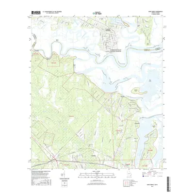
2017 Map of Saint Marys
USGS Topo · Published 2017About this map
The Saint Marys River serves as the winding centerpiece for this coastal borderland, marking the boundary between Georgia and Florida. In the north, the historic street grid of Saint Marys is well-defined, bordered by the North River and the marshes of the Cumberland Island National Seashore. This area is rich with family history markers, including Oak Grove Cem and Higginbotham Cem, reflecting generations of settlement along the waterways.
Find a feature on this map
152 named features on this map. Tap any name to fly to it.
Don’t see what you’re looking for? This feature index may not catch every label — zoom into the map to look around manually.
Map Details
Editions of this 2017 Saint Marys Map
This is the sole edition of this map. No revisions or reprints were ever made.
Other maps of this area

1918 · St Marys
USGS Topo · 1:62,500

1918 · Cumberland Island
USGS Topo · 1:62,500

1918 · Kingsland
USGS Topo · 1:62,500

1919 · Fernandina
USGS Topo · 1:62,500

1919 · St Marys
USGS Topo · 1:62,500

1930 · Cumberland Island
USGS Topo · 1:62,500

1944 · Fernandina
USGS Topo · 1:62,500

1945 · Cumberland Island
USGS Topo · 1:62,500

1948 · Jacksonville
USGS Topo · 1:250,000

1957 · Jacksonville
USGS Topo · 1:250,000