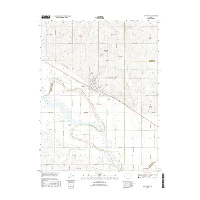
2016 Map of Saint Marys
USGS Topo · Published 2016About this map
The St. Marys community anchors this central Kansas landscape, situated where the high plains meet the broad valley of the Kansas River. Historically significant travel corridors are evident in the alignment of Oregon Trail Rd, reflecting the region's legacy as a gateway to the West. The town's religious and civic infrastructure is represented by landmarks such as St. Joseph's church and two local burial grounds, Valley View Cem and Mount Calvary Cem.
Find a feature on this map
88 named features on this map. Tap any name to fly to it.
Don’t see what you’re looking for? This feature index may not catch every label — zoom into the map to look around manually.
Map Details
Editions of this 2016 Saint Marys Map
This is the sole edition of this map. No revisions or reprints were ever made.
Other maps of this area

1889 · Wamego
USGS Topo · 1:125,000

1889 · Topeka
USGS Topo · 1:125,000

1894 · Topeka
USGS Topo · 1:125,000

1894 · Wamego
USGS Topo · 1:125,000

1950 · Kansas City
USGS Topo · 1:250,000

1952 · Rossville
USGS Topo · 1:24,000
1952 · Willard
USGS Topo · 1:24,000

1953 · Maple Hill
USGS Topo · 1:24,000

1953 · Belvue
USGS Topo · 1:24,000

1953 · St Marys
USGS Topo · 1:24,000