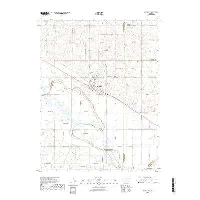
2018 Map of Saint Marys
USGS Topo · Published 2018About this map
St. Marys serves as the central hub of this Kansas landscape, situated near the confluence where Doyle Creek and College Cr meet the northward bend of the Kansas River. This 2018 survey illustrates the town's grid of residential streets like W Bertrand Ave and W Lasley St, while highlighting its position along the Oregon Trail Rd, a modern artery following the path of one of the nation's most famous westward routes.
Find a feature on this map
84 named features on this map. Tap any name to fly to it.
Don’t see what you’re looking for? This feature index may not catch every label — zoom into the map to look around manually.
Map Details
Editions of this 2018 Saint Marys Map
This is the sole edition of this map. No revisions or reprints were ever made.
Other maps of this area

1889 · Wamego
USGS Topo · 1:125,000

1889 · Topeka
USGS Topo · 1:125,000

1894 · Topeka
USGS Topo · 1:125,000

1894 · Wamego
USGS Topo · 1:125,000

1950 · Kansas City
USGS Topo · 1:250,000

1952 · Rossville
USGS Topo · 1:24,000
1952 · Willard
USGS Topo · 1:24,000

1953 · Maple Hill
USGS Topo · 1:24,000

1953 · Belvue
USGS Topo · 1:24,000

1953 · St Marys
USGS Topo · 1:24,000