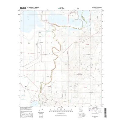
2015 Map of Saint Maurice
USGS Topo · Published 2015About this map
Saint Maurice sits at the southern edge of this Louisiana landscape, positioned where the Little Natches Bayou meets the winding course of the Red River and Old River. The terrain is defined by a dense network of waterways and low-lying basins, including the southern reaches of Black Lake and Saline Lake. Within the Kisatchie National Forest, the topography rises toward distinctive landmarks such as The Butte and Cedar Bluff. Local family history is rooted in the small settlements of Trichell and Luella, with further genealogy data found at Pace Cem and Saline Cem. The complex drainage patterns of Bourbeaux Bayou, Cane Bayou, and Brule Bayou illustrate the seasonal hydrology that has shaped land use and road development in this part of Natchitoches and Winn Parishes.
Find a feature on this map
66 named features on this map. Tap any name to fly to it.
Don’t see what you’re looking for? This feature index may not catch every label — zoom into the map to look around manually.
Map Details
Editions of this 2015 Saint Maurice Map
This is the sole edition of this map. No revisions or reprints were ever made.
Other maps of this area

1935 · Verda
USGS Topo · 1:31,680

1937 · Campti NE
USGS Topo · 1:31,680

1937 · Bermuda
USGS Topo · 1:31,680

1937 · Campti SE
USGS Topo · 1:31,680

1937 · Montgomery
USGS Topo · 1:62,500

1942 · Montgomery
USGS Topo · 1:62,500

1943 · Provencal
USGS Topo · 1:62,500

1944 · Campti
USGS Topo · 1:62,500

1945 · Montgomery
USGS Topo · 1:62,500

1945 · Provencal
USGS Topo · 1:62,500