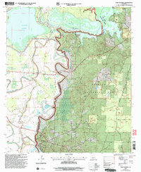
2003 Map of Saint Maurice
USGS Topo · Published 2005About this map
St Maurice Plantation and the village of St Maurice anchor the southern reaches of this landscape where the Red River and Saline Bayou converge at the border of Winn and Natchitoches Parishes. The area is defined by the winding course of the bayou, which separates the agricultural lands and spoil banks of the west from the dense woodlands of the Kisatchie National Forest to the east. This transition from river bottomlands to upland forest is marked by numerous small communities and religious centers, including Trichell, Luella, and several country churches such as Mt Pilgrim Ch and Harmony Ch.
Find a feature on this map
53 named features on this map. Tap any name to fly to it.
Don’t see what you’re looking for? This feature index may not catch every label — zoom into the map to look around manually.
Map Details
Editions of this 2003 Saint Maurice Map
This is the sole edition of this map. No revisions or reprints were ever made.
Other maps of this area

1935 · Verda
USGS Topo · 1:31,680

1937 · Campti NE
USGS Topo · 1:31,680

1937 · Bermuda
USGS Topo · 1:31,680

1937 · Campti SE
USGS Topo · 1:31,680

1937 · Montgomery
USGS Topo · 1:62,500

1942 · Montgomery
USGS Topo · 1:62,500

1943 · Provencal
USGS Topo · 1:62,500

1944 · Campti
USGS Topo · 1:62,500

1945 · Montgomery
USGS Topo · 1:62,500

1945 · Provencal
USGS Topo · 1:62,500