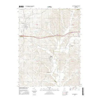
2016 Map of Saint Meinrad
USGS Topo · Published 2016About this map
The monastic and educational center of Saint Meinrad anchor this landscape at the intersection of Dubois, Perry, and Spencer counties. This area is characterized by the Anderson River and its numerous tributaries, including Blackhawk Cr and Crooks Hollow Cr, which carve through the terrain near the Saint Meinrad Sch of Theology. The map reveals a pattern of rural life organized around small water bodies and family legacy sites, such as Saint Meinrad Lake and several ancestral burial grounds including Taylor Cem and Stapleton Cem.
Find a feature on this map
105 named features on this map. Tap any name to fly to it.
Don’t see what you’re looking for? This feature index may not catch every label — zoom into the map to look around manually.
Map Details
Editions of this 2016 Saint Meinrad Map
This is the sole edition of this map. No revisions or reprints were ever made.
Other maps of this area

1900 · St Meinrad
USGS Topo · 1:62,500

1903 · St. Meinrad
USGS Topo · 1:62,500

1954 · Huntingburg
USGS Topo · 1:24,000

1955 · Saint Anthony
USGS Topo · 1:24,000

1956 · Vincennes
USGS Topo · 1:250,000

1957 · Vincennes
USGS Topo · 1:250,000

1957 · Birdseye
USGS Topo · 1:24,000
1957 · Bristow
USGS Topo · 1:24,000

1958 · Vincennes
USGS Topo · 1:250,000
1958 · Gatchel
USGS Topo · 1:24,000