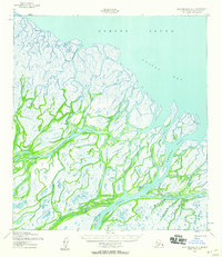
1952 Map of Saint Michael A-4
USGS Topo · Published 1958About this map
Norton Sound and Pastol Bay dominate the northern shoreline of this coastal landscape, where the intricate distributary network of the Yukon Delta meets the sea. The 1952 survey highlights the primary settlement of Kotlik situated near the confluence of the Kotlik River and Little Kotlik River. Navigation through this water-logged terrain relied heavily on major channels such as Apoon Pass, Okwega Pass, and Okshokwewhik Pass, while several cabins and navigational aids like the Kotlik Crossing Light mark the sparse human presence. A Winter Trail provides a rare terrestrial route across the marshy interior, connecting smaller waterways like Kaweehnak Slough and Apakshau Slough. The map documents a period of strategic importance for the U.S. Army, which mapped the area using photogrammetric methods from aerial photography taken in 1951.
Find a feature on this map
24 named features on this map. Tap any name to fly to it.
Don’t see what you’re looking for? This feature index may not catch every label — zoom into the map to look around manually.
Map Details
Editions of this 1952 Saint Michael A-4 Map
2 editions found
Other maps of this area

1951 · St Michael
USGS Topo · 1:250,000

1952 · Kwiguk
USGS Topo · 1:250,000

1952 · Saint Michael A-5
USGS Topo · 1:63,360

1952 · Kwiguk D-3
USGS Topo · 1:63,360
1952 · Saint Michael A-3
USGS Topo · 1:63,360

1952 · Kwiguk D-5
USGS Topo · 1:63,360

1952 · Kwiguk D-4
USGS Topo · 1:63,360

1952 · St Michael
USGS Topo · 1:250,000

1964 · St. Michael
USGS Topo · 1:250,000
2020 · Kwiguk D-4 NE
USGS Topo · 1:25,000