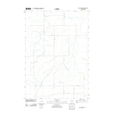
2012 Map of Saint Onge SE
USGS Topo · Published 2012About this map
Whitewood Cr and its many tributaries, including Crow Cr and Cottonwood Cr, dominate this section of the South Dakota landscape. The map shows a transition from the rolling plains of Meade County toward the Black Hills, characterized by a complex drainage network and a strictly organized grid of local roads. Key transit corridors such as Whitewood Valley Rd and Stinking Water Rd follow the natural contours of the creeks, providing insight into how early settlement and ranching routes adhered to reliable water sources. The 2012 topography reveals the persistence of rural land divisions, with numbered roads like 194th St and 200th St cutting across the north-south valleys of Stinkingwater Cr and Ash Cr.
Find a feature on this map
21 named features on this map. Tap any name to fly to it.
Don’t see what you’re looking for? This feature index may not catch every label — zoom into the map to look around manually.
Map Details
Editions of this 2012 Saint Onge SE Map
This is the sole edition of this map. No revisions or reprints were ever made.
Other maps of this area

1893 · Rapid
USGS Topo · 1:125,000

1894 · Deadwood
USGS Topo · 1:125,000

1898 · Rapid
USGS Topo · 1:125,000

1899 · Sturgis
USGS Topo · 1:62,500

1901 · Deadwood
USGS Topo · 1:125,000

1903 · Rapid
USGS Topo · 1:125,000

1905 · Saint Onge
USGS Topo · 1:62,500

1906 · Vale
USGS Topo · 1:62,500

1907 · Belle Fourche
USGS Topo · 1:125,000

1913 · Newell
USGS Topo · 1:125,000