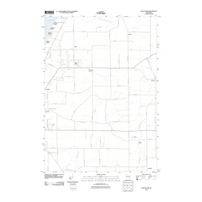
2010 Map of Saint Peter
USGS Topo · Published 2010About this map
The eastern shores of Lake Winnebago define the western edge of this Fond du Lac County landscape, where the lakefront transitions from seasonal beach communities like Bergen Beach and Linden Beach to the higher elevations of the Niagara Escarpment. The settlement of Saint Peter sits central to a grid of agricultural lands and limestone ledges, flanked by the smaller hamlets of Silica and Malone. This 2010 survey illustrates a region where headwaters of multiple river systems emerge; the South Branch Manitowoc River flows toward the northeast, while the Sheboygan River and Taycheedah Creek drain the southern reaches. Local heritage is deeply rooted in the numerous rural burial grounds that dot the townships, including Saint Charles Cemetery and Holy Cross Cemetery. The map also captures specialized transport and recreation infrastructure, from the Nett Construction Airport near the center of the quadrangle to the developed residential corridors of Peebles and the winding paths along Ledge Rd.
Find a feature on this map
57 named features on this map. Tap any name to fly to it.
Don’t see what you’re looking for? This feature index may not catch every label — zoom into the map to look around manually.
Map Details
Editions of this 2010 Saint Peter Map
This is the sole edition of this map. No revisions or reprints were ever made.
Other maps of this area

1910 · Fond du Lac
USGS Topo · 1:62,500

1954 · Kiel
USGS Topo · 1:62,500

1955 · Campbellsport
USGS Topo · 1:62,500

1955 · Kewaskum
USGS Topo · 1:62,500

1955 · Fond Du Lac
USGS Topo · 1:62,500

1955 · Fond Du Lac
USGS Topo · 1:24,000

1957 · Madison
USGS Topo · 1:250,000

1960 · Madison
USGS Topo · 1:250,000

1974 · St. Cloud
USGS Topo · 1:24,000
1974 · Dundee
USGS Topo · 1:24,000