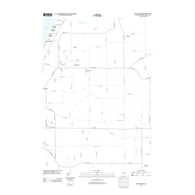
2013 Map of Saint Peter
USGS Topo · Published 2013About this map
The eastern shores of Lake Winnebago define the western edge of this landscape, where a string of lakeside communities including Welling Beach, Gladstone Beach, Bergen Beach, and Linden Beach dot the coastline. Moving inland, the terrain transitions into a grid of agricultural and rural residential plots centered around the crossroads of Saint Peter and the small settlement of Silica. This region is characterized by its drainage patterns, with the S Br Manitowoc River and Sheboygan River carving through the countryside alongside Taycheedah Cr. A notable landmark in the central portion of the map is the Nett Construction Airport, providing a point of interest for aviation history. The road network, including Us-151 and County Road WH, connects these outlying hamlets to the larger area, while the town of Peebles sits near the base of the prominent ledge that runs through the county.
Find a feature on this map
73 named features on this map. Tap any name to fly to it.
Don’t see what you’re looking for? This feature index may not catch every label — zoom into the map to look around manually.
Map Details
Editions of this 2013 Saint Peter Map
This is the sole edition of this map. No revisions or reprints were ever made.
Other maps of this area

1910 · Fond du Lac
USGS Topo · 1:62,500

1954 · Kiel
USGS Topo · 1:62,500

1955 · Campbellsport
USGS Topo · 1:62,500

1955 · Kewaskum
USGS Topo · 1:62,500

1955 · Fond Du Lac
USGS Topo · 1:62,500

1955 · Fond Du Lac
USGS Topo · 1:24,000

1957 · Madison
USGS Topo · 1:250,000

1960 · Madison
USGS Topo · 1:250,000

1974 · St. Cloud
USGS Topo · 1:24,000
1974 · Dundee
USGS Topo · 1:24,000