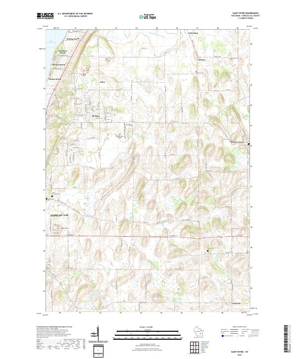
2022 Map of Saint Peter
USGS Topo · Published 2022About this map
Lake Winnebago forms the western boundary of this landscape, where the shoreline is defined by a string of residential pockets including Welling Beach, Gladstone Beach, Bergen Beach, and Linden Beach. Moving inland, the terrain transitions from these lakeside communities to the agricultural heart of Fond du Lac County. The map documents a cluster of established hamlets and unincorporated communities such as Johnsburg, Silica, Malone, and St. Peter, each serving as local centers for the surrounding farmstead network.
Find a feature on this map
87 named features on this map. Tap any name to fly to it.
Don’t see what you’re looking for? This feature index may not catch every label — zoom into the map to look around manually.
Map Details
Editions of this 2022 Saint Peter Map
This is the sole edition of this map. No revisions or reprints were ever made.
Other maps of this area

1910 · Fond du Lac
USGS Topo · 1:62,500

1954 · Kiel
USGS Topo · 1:62,500

1955 · Campbellsport
USGS Topo · 1:62,500

1955 · Kewaskum
USGS Topo · 1:62,500

1955 · Fond Du Lac
USGS Topo · 1:62,500

1955 · Fond Du Lac
USGS Topo · 1:24,000

1957 · Madison
USGS Topo · 1:250,000

1960 · Madison
USGS Topo · 1:250,000

1974 · St. Cloud
USGS Topo · 1:24,000
1974 · Dundee
USGS Topo · 1:24,000