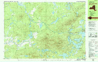
1979 Map of Saint Regis Mtn
USGS Topo · Published 1979About this map
Adirondack Park serves as the backdrop for this late 1970s survey, centered on the high peaks and sprawling wetlands of the St. Regis area. The settlement of Paul Smiths and the historic Keese Mill anchor the eastern side of the quadrangle, while the water-rich landscape is defined by the interconnected Upper Saint Regis Lake, Spitfire Lake, and Lower Saint Regis Lake. Higher elevations such as Saint Regis Mtn and Jenkins Mountain rise above a dense network of smaller bodies including Saint Regis Pond and Fish Pond. The map illustrates a region managed for conservation and recreation, noted by the Girl Scout Camp and the winding course of the Saint Regis River. Private land boundaries and forestry roads like Blue Mountain Road indicate the modern land-use patterns of this Franklin County wilderness prior to the turn of the century.
Find a feature on this map
57 named features on this map. Tap any name to fly to it.
Don’t see what you’re looking for? This feature index may not catch every label — zoom into the map to look around manually.
Map Details
Editions of this 1979 Saint Regis Mtn Map
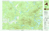
2 editions found
Other maps of this area

1902 · Saranac
USGS Topo · 1:62,500

1904 · Saranac
USGS Topo · 1:62,500

1905 · Saint Regis
USGS Topo · 1:62,500

1906 · Loon Lake
USGS Topo · 1:62,500

1908 · Loon Lake
USGS Topo · 1:62,500

1919 · Nicholville
USGS Topo · 1:62,500

1920 · Childwold
USGS Topo · 1:62,500

1921 · Childwold
USGS Topo · 1:48,000

1921 · Nicholville
USGS Topo · 1:62,500

1921 · Santa Clara
USGS Topo · 1:62,500