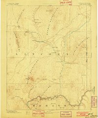
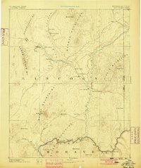
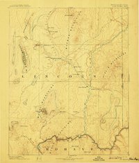
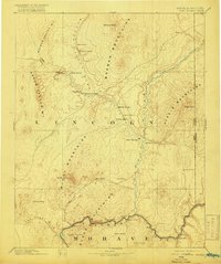
1886 Map of Saint Thomas
USGS Topo · Published 1902About this map
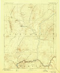
Saint Thomas and Saint Joseph anchor a desert landscape defined by the convergence of the Virgin River and the Colorado River in this late nineteenth-century reconnaissance. The geography reveals a transit-heavy economy long before the creation of modern reservoirs, where movement depended on historic routes like the Old California Trail and the strategically placed Stone Ferry at the mouth of Boulder Canyon.
Find a feature on this map
44 named features on this map. Tap any name to fly to it.
Don’t see what you’re looking for? This feature index may not catch every label — zoom into the map to look around manually.
Map Details
Editions of this 1886 Saint Thomas Map
6 editions found
Other maps of this area

1885 · St. George
USGS Topo · 1:250,000

1885 · Pioche
USGS Topo · 1:250,000

1886 · Diamond Creek
USGS Topo · 1:250,000

1886 · Camp Mohave
USGS Topo · 1:250,000

1886 · Saint Thomas
USGS Topo · 1:250,000

1886 · Mt. Trumbull
USGS Topo · 1:250,000

1886 · Pioche
USGS Topo · 1:250,000

1891 · St. George
USGS Topo · 1:250,000

1892 · Diamond Creek
USGS Topo · 1:250,000

1892 · Mt. Trumbull
USGS Topo · 1:250,000