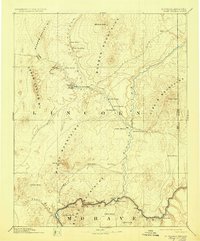
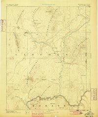
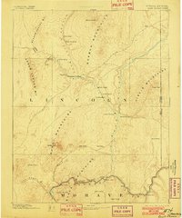
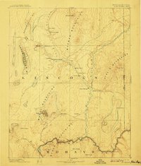
1886 Map of Saint Thomas
USGS Topo · Published 1929About this map
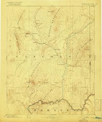
Saint Thomas and the surrounding Virgin River Valley are documented here before the modern landscape was transformed by dam construction. This late 19th-century survey, based on topography by the Powell Surveys, shows a desert frontier of early Mormon settlements and critical transportation corridors. The Virgin River meets the Colorado River near Old Callville, a site of significant logistical importance for river navigation. Long-distance travel is defined by the Old California Trail and the Millers Cutoff, which weave through the desert between the Mormon Mountains and Arrow Canyon Mts. Genealogists and historians can trace the foundations of early towns like Overton, Old Overton, and Saint Joseph, as well as river crossings such as Stone Ferry and Scanlon Ferry. The map also captures the Moapa Ind Res and the Old California Crossing on the Muddy Wash.
Find a feature on this map
46 named features on this map. Tap any name to fly to it.
Don’t see what you’re looking for? This feature index may not catch every label — zoom into the map to look around manually.
Map Details
Editions of this 1886 Saint Thomas Map
6 editions found
Other maps of this area

1885 · St. George
USGS Topo · 1:250,000

1885 · Pioche
USGS Topo · 1:250,000

1886 · Diamond Creek
USGS Topo · 1:250,000

1886 · Camp Mohave
USGS Topo · 1:250,000

1886 · Saint Thomas
USGS Topo · 1:250,000

1886 · Mt. Trumbull
USGS Topo · 1:250,000

1886 · Pioche
USGS Topo · 1:250,000

1891 · St. George
USGS Topo · 1:250,000

1892 · Diamond Creek
USGS Topo · 1:250,000

1892 · Mt. Trumbull
USGS Topo · 1:250,000