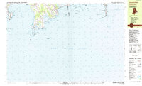
1984 Map of Sakonnet Point
USGS Topo · Published 1984About this map
Sakonnet Point anchors a maritime landscape defined by treacherous ledges and protective wildlife sanctuaries along the Rhode Island and Massachusetts border. The 1980s coastal profile highlights the transition from the Sachuest Point National Wildlife Refuge in the west to the expansive Horseneck Beach State Reservation in the east. Inland from the Sakonnet River, the village of Sakonnet and the cluster at Bahia Corner sit amongst several distinctive coastal features, including the marshy expanse of Briggs Marsh and the tidal waters of Quicksand Pond. Local history and architecture are represented by the St Andrews by the Sea Ch and the intriguing Woods Castle. Navigation has long been the primary concern here, evidenced by the Lighthouse (Abandoned) and an extensive network of named hazards like Schuyler Ledge and Cormorant Rock that fill the Rhode Island Sound.
Find a feature on this map
62 named features on this map. Tap any name to fly to it.
Don’t see what you’re looking for? This feature index may not catch every label — zoom into the map to look around manually.
Map Details
Editions of this 1984 Sakonnet Point Map
This is the sole edition of this map. No revisions or reprints were ever made.
Other maps of this area

1885 · New Bedford
USGS Topo · 1:62,500

1885 · Sakonnet
USGS Topo · 1:62,500

1888 · New Bedford
USGS Topo · 1:62,500

1888 · Fall River
USGS Topo · 1:62,500

1888 · Sakonnet
USGS Topo · 1:62,500

1889 · Newport
USGS Topo · 1:62,500

1890 · Narragansett Bay
USGS Topo · 1:62,500

1892 · Narragansett Bay
USGS Topo · 1:62,500

1893 · Sakonnet
USGS Topo · 1:62,500

1893 · Fall River
USGS Topo · 1:62,500